The story of the cat and the mouse
In house number five on Kosmonavtov Street, on the third floor in apartment one hundred and twenty-four, there lived a cat named Belka.
Her owners loved her very much, spoiled her in every possible way, and bought her new toys. But the little girl Tanya loved Belka most of all. She even took the cat with her to bed at night. It used to be that Tanya would have a terrible dream, she would get up, grab Belka with both arms and pull her with her. And the cat is only happy about it.
But one day Tanya and her mother went to the pet store and brought home... a mouse. Small, white, in a cage with a wheel. When Squirrel saw that mouse, she almost fainted.
Where have you seen mice live in complete contentment in a house? They are supposed to be caught with mousetraps or cats.
And this mouse also turned out to be impudent. When everyone in the house falls asleep, the lights are turned off, Belka also falls asleep, the mouse slowly gets out of the cage and begins to roam around the rooms, putting things in order. One day Belka caught her in the kitchen in front of a bag of semolina. I tried to chase her, but didn’t have time. The mouse climbed onto the wall, along the wall to the ceiling, and along the ceiling back into Tanya’s bedroom and into his cage. She closed the door and sat there, not moving. It seems like she wasn’t acting out at all.
In fairness
Then Squirrel decided to catch this mouse and eat it. No mouse, no problem. She waited until the night was dark and moonless and pretended to be asleep. The mouse only stuck its sharp nose into the kitchen, only got close to the bag of cereal, and then Squirrel grabbed it.
She held it between her paws and was about to swallow it. She has already revealed her sharp teeth. And as soon as I looked at this tiny animal, all my appetite instantly disappeared. Belka felt sorry for her mistress. How will she grieve for the mouse, poor thing? And she released the rodent. So, either the mouse realized its mistake, or it was scared to death, but since then it hasn’t pulled any more tricks. She sat quietly in the cage and didn’t do anything around the house.
The image of a cat (cat) in Russian folk tales
The cat is a storyteller, he is also a desired treasure
The most striking fairy-tale image of a cat in a Russian fairy tale is Cat Bayun
from the fairy tale
“Go there I don’t know where.”
Here he
is the object of the search, a kind of miracle and at the same time an impossible (almost) task given to the main character
. By the way, Bayun (from the word “bayat”, that is, “to tell”) in different versions of this fairy tale is either the cat’s personal name, or is written with a hyphen with a small letter, that is, it simply indicates his gift as a storyteller.
In general, this is one of the most unusual tales of Russian folklore.
, which seems to exist on its own or comes from a slightly different source than most of the stories we are accustomed to from childhood.
To begin with, the main character here is in different versions - Andrei the Sagittarius , Fedot the Sagittarius, soldier Tarabanov or a merchant's son nicknamed Bezdolny, but never (!) Ivan the Fool or Tsarevich
. Most often he is a royal hunter, supplying game to the sovereign's table. Another “unusuality” is that the hero gets his beautiful wife not at the end of the story, as some kind of reward, but at the very beginning - for no reason at all, then the plot is built around the fact that Sagittarius has to carry out more and more difficult tasks for the king, who simply wants to drive him away from the world in order to marry Princess Marya himself.The tasks vary in different versions of the fairy tale (for example, go find out how the king’s dead father lives in the next world, get golden horns for a deer, golden horns for a goat, a magic mare...
), .
Usually there are three of them and the most important and difficult is the last one - “I don’t know what.”
In fact, the situation becomes even stranger when it turns out that this “I don’t know what” is
an invisible helper or force... named “matchmaker Naum”
!
In other versions it is "Shmat-razum" , "Saura" or simply Nobody.
None of these names appear in other Russian fairy tales.
Andrey the Sagittarius
and the cat Bayun.
Illustration for the fairy tale “Go there - I don’t know where.” In the version recorded by Alexei Tolstoy, one of the royal tasks is precisely the extraction of the bajun cat. The danger of this enterprise lies in the fact that the cat can charm anyone with its fairy tales and send them into an uninterrupted
slumber .
It is noteworthy that
he sits on a high iron pillar, far away in the distant kingdom.
To catch the cat, the shooter, on the advice of his wife, takes with him
three iron caps, three rods and pincers
- the caps protect the hero from the cat's claws, and with the pincers he pulls him off the post.
Soon the fairy tale is told, but not soon the deed is done -
Andrei the shooter to the thirtieth kingdom. Three miles away, sleep began to overcome him. Andrei puts three iron caps on his head, throws his arm over his arm, drags his legs over his legs - he walks, and then rolls around like a roller. Somehow I managed to doze off and found myself at a high pillar.
The cat Bayun saw Andrei, grumbled, purred, and jumped from the post on his head - he broke one cap and broke another, and was about to grab a third.
Then Andrei the shooter grabbed the cat with pincers, dragged him to the ground and started stroking him with the rods...
It is interesting that although at first the cat fights with the hero tooth and nail, but, recognizing himself defeated, he completely loses his hostility and, of his own free will, follows the shooter to where he is leading him.
G.S. Zubkovsky. Cat Bayun on a pole. 1951 “Go there, I don’t know where, bring something, I don’t know what.”
In one of the versions of the tale as recorded by Afanasiev
(No. 215 from volume 2), and in total he has four of them -
ot -bayun is the last building, that is, even more complex than “I don’t know what”
, it is with its capture and taming that the fairy tale ends.
Moreover, the cat here is not a passive object, but an active character
who ultimately helps the archer defeat his enemy - the royal governor.
They walked and and
walked and walked and got where they needed to be; come to the palace, the king saw the cat-bayun and orders: “Come on, cat-bayun ! Show me more passion." The cat sharpens his claws, he gets along with the king; wants to tear his white chest apart, take his living heart out. The Tsar was frightened and began to beg Bezdolny: “Please calm down the bajun cat ! I’ll do anything for you.” - “Bury the governor alive in the ground, now I’ll eat a lot.” The king agreed; They immediately grabbed the governor by the arm and leg, dragged him into the yard and buried him alive in the cheese. And Bezdolny remained to live under the king; the cat-bayun obeyed them both, no one waited on them, and they lived long and cheerfully. That's the whole fairy tale, you can't say more.
The author of the painting is unknown.
The image of the scientist cat Alexander Sergeevich Pushkin, apparently, goes back precisely to such fairy tales about the magical story teller of the cat Bayun.
There is a green oak near the Lukomorye;
Golden chain on the oak tree:
Day and night the cat is a scientist
Everything goes around and around in a chain
;
He goes to the right - the song starts,
To the left - he tells a fairy tale...
Cat - navigator
In some Russian fairy tales, a cat makes a cameo appearance when
one of the characters (a young girl/woman, Ivan) gets lost in the forest.
Here the cat acts as a savior, showing the way out of the thicket . He is initially friendly towards the main character, helps him on his own initiative and completely disinterestedly, and then disappears. After it, two more animals can come to the hero’s aid (which forms a canonical threefold repetition of the event), one of which is usually a gray wolf.
Earth cat. Author unknown. The earthen cat is found in Ural legends, according to which it points to treasures buried in the ground.
This image often includes cats from more “children’s” instructive stories,
in which only animals act and there is no Ivan, no girls, no Baba Yaga, no Koshchei.
For example, “The Cat and the Rooster,” where the cat saves an unlucky rooster from the clutches of a fox who kidnapped him
:
Brother cat!
The fox is carrying me
For the dark forests
For the high mountains
Into a deep hole
Help me out!
The cat is a companion of the otherworldly
Finally, the cat - usually black - is
Baba Yaga's
.
In these fairy tales, he is not an active character in principle, he simply exists, as some kind of integral attribute. That is, here he is a companion of some otherworldly force, capable of easily walking between worlds
. This clearly follows from the very image of Baba Yaga, who is on the border, at a crossroads - half alive, half dead (“bone leg”). It is interesting that in most Indo-European cultures, any asymmetry indicates partial belonging to the other world (blindness in one eye, lameness, etc.). In addition, in some Russian fairy tales there is a direct indication that Baba Yaga’s hut stands on the Smorodina River, separating the world of the Dead from the Living.
In this regard, it is important to note that belonging to the other world in itself is NOT at all
something “creepy” or “bad”
, because not only monsters live in Navi, but also deceased ancestors, that is, friends and intercessors. However, Baba Yaga herself is neither a uniquely positive nor a uniquely negative character. In some stories, she can kidnap babies with the aim of eating them, and in others she already helps the main character, giving valuable instructions and objects.
Another otherworldly character associated with a cat is the brownie
. Folk legends indicate that the cat sees him perfectly, communicates with him and is a faithful assistant to the home guardian.
It was believed that cats and all other otherworldly entities could see - mermaids, goblin, devils. Is this the reason for the strange hissing of pets at empty corners, often observed by their owners?
Vsevolod Ivanov. Brownie
The cat lulls babies to sleep with lullabies
Finally, the cat is the most common character in children's lullabies.
It is kittens who are invited by mothers to the cradles of their babies to rock them, sing sweet songs to them and guard their dreams.
Kitty-kitten , cat,
Kitty's gray pubis,
Come and spend the night with us,
Rock my baby.
It seems that it could be simpler and more logical? After all, the cat is essentially the only pet in the house in the full sense, and besides, it has the excellent ability to purr soothingly. But perhaps our ancestors understood the essence of things much better than us - and cats were invited to children’s lullabies also because the vibration frequency
when a cat purrs (from 20 to 150 Hz)
has a healing effect
- this is the frequency range used today in medicine for physiotherapy treatment. By the way, scientists don’t know how and why cats purr.
The author of the picture is unknown
The Tale of the Cat and the Mouse Nathanya
Nafanya started up in the same house. Well, she was amazing! For example, everyone wakes up in the morning and looks at the nut pie on the table in the evening, but now it’s not there. Only crumbs remained. They marvel - who did this outrage? And dad says: “Probably Nafanya.”
The cat Dasha heard about this and thought: “Wow! What kind of Nafanya is this? Is it really a mouse?
The next day, someone defaced all the wallpaper in the room. With orange, blue and red colors. The adults, when they saw it, almost fainted. Dad says: “Well, who did it?”
There’s a little boy, Vanechka, who quietly answers: “Nafanya...
Then dad says: “That’s how we got Nafanya!” He eats pies and paints wallpaper. Will there be anything next?
And the cat Dashka was already completely scared. What kind of mouse is this, incredibly literate?
A few more days passed and by morning the parents found a high chair in the kitchen, placed on the top shelf. And on the top shelf there was a whole box of chocolates. So now there is not a single piece of candy left in the box.
Dad says: “Well, our Nafanya is gone!” We probably need to take action. And the cat Dashka thinks to himself: “It’s very lucky that we got this mouse! You can get into trouble and blame everything on her.” Dasha sneaked into the kitchen in the evening, opened the refrigerator, took out a hefty piece of cheese and ate it.
The next morning, when the loss was discovered, mom and dad clasped their hands: “Dasha!” Yes, where have you seen cats roaming refrigerators? - and punished the cat.
She sits poor in the closet and cannot understand anything. Why is it that, like eating candy and pies, it means Nafanya, but like eating cheese, it’s Dasha’s fault?
Fairy tale poems about a mouse and a cat
There is a magical place in our kitchen, near the stove. A door with a tiny lock, and behind it a house of mice.
Exactly at midnight, from behind the stove, Grabbing candles for light, the mice in a friendly crowd set off on a robbery.
They eat cereals and porridge, drink kvass from a bowl, refresh themselves with potatoes, and juggle peas.
Quietly, quietly, don't make any noise, they tell the cat to sleep. When he wakes up, that’s the problem! Then she will eat the mice.
But Murka doesn’t hear yet, Sleeping, the shiny jacket. Drinking milk at night, satisfying your hunger.
Well-fed people always want to sleep, They yawn all day long. Tolley is a matter on an empty stomach. Catch mice for a nickel.
In the meantime, they are roaming around, stealing food here and there, so that their pantries are all driven up to the ceilings.
You are the owners of animals, willing mouse-catchers, listen to my advice - Don’t give them cutlets.
Do not serve butter, cheese, pies or bread from the tandoor. Do not give milk or raw cottage cheese.
And then your little cats, in an unusual aerobatics, will announce a battle to the mice, revealing their strong-willed character.
Read the tale about the cat Shura and the mouse Nyura
Once upon a time there lived a mouse named Nyura in my grandmother's lower kitchen. She wasn’t especially willful, she didn’t spoil the food, so grandma didn’t touch her. Let him live.
And upstairs in the house lived the cat Shura. She was strict and vigilantly watched over the house so that not a single mouse was found. And she never went down to the lower kitchen. There was a vat of sourdough at my grandmother’s place, and Shura was about to drink from it one day and fell into the sourdough. Her grandmother scolded her very painfully afterwards.
One day Shura was sitting by the hatch into the underground, where the lower kitchenette was, and saw a picture: a mouse was walking and wandering around the kitchen, slowly, like a businessman. He’ll go up to the stove and see what’s cooking there, he’ll go up to the cabinets and check everything around him, he’ll go up to the leaven in the vat and stick his nose in there.
The cat Shura became furious, her fur stood on end. She looks with her eyes, but can’t do anything. The fear was deeply ingrained in her. Then she decided to use a trick. She got a thread somewhere, tied a piece of cheese to one end of it and lowered it into the underground.
Nyura noticed the cheese, sharpened her teeth, but she wanted to grab it like cheese - she hopped and moved away. The mouse is behind him. And the cheese for the ladder - skok-skok-skok. The mouse ran after him. She was almost getting what she wanted, when suddenly the cheese slipped out through the hatch into the house.
Then the mouse realized that something was wrong. She hid between the steps and sat and waited. Not a minute had passed before the cat appeared. But no matter how much she looked out, no matter how much she lowered her muzzle into the underground, she could not understand why her prey had been lost.
Mouse Mind
It was then that the mouse realized that the cat was afraid of the underground. And she began to tease her in every possible way. As soon as he notices that Shura is sitting on the edge of the hatch, he will immediately come out of his hiding place and walk back and forth in the lower kitchen, like a housewife. And she became so arrogant that she completely forgot about her agreement with her grandmother.
And the grandmother, when she saw that the mouse was completely insolent, put a mousetrap in the kitchen and caught it.
That's the whole story for you. It’s not for nothing that they say that the jug was proud until it broke.
The Tale of the Cat and the Mouse
Once a cat caught a mouse. He opened his mouth, just about to eat. And she tells him:
- Don't eat me, kitty! Look, I'll be useful to you. - Yes, what good are you? - the cat grins. - You look so small. You'll get hit and there won't be a wet place left. “Don’t eat me,” the mouse babbles on and on. - You'll see, it will be good for me too. The cat thought, “okay, you won’t be satisfied with one mouse” and let her go in peace.
Now, time is passing. The owner got angry with the cat because he ate all the sour cream and decided to kick him out of the house. The cat was completely sad. He thinks “I’ll disappear on the street.” He sits and sheds tears. Then, out of nowhere, a mouse crawls out: “What are you crying about, little cat?”
He told her his misfortune. And she tells him: “Don’t cry.” You spared me, so I will do good to you.
In the evening the owner is sitting drinking tea with bagels, and suddenly he sees a mouse walking across the table right before his eyes. He approaches the bagels, takes one and begins to gnaw.
From such impudence, the owner almost turned green. - Cat! - he shouts. - Well, catch me this impudent one! And the cat is happy to try. He flew up like a bullet and caught the mouse. And he ate it. Make-believe. And when the owner turned away, he released her. And from that day on, the cat and mouse became best friends.
Box
It happened on a postal day. A postman named Polyusov walked through the village with his bag at the ready and hummed some song to himself. I bent down to tie my shoelaces and dropped one box. I didn't notice and moved on. Just then the kittens went out for a walk. They saw the box. They were delighted and began to kick her along the road like a ball. They chased and chased until the red kitten came out into the street. He saw such a thing and said to the others: “It’s not good to play with other people’s parcels.” We need to deliver this box to the addressee.
It is necessary, but how to do it? Where to look for the addressee? Kittens, of course, can’t read.
They dragged the box to the chickens in the chicken coop: - Aunt chickens, tell me what the address is written here? - How do we know? Where-where! How much? Don't know? We can't know! - the chickens cackled.
The kittens dragged the box to the meadow to the goat: - Aunt goat, tell me what is written on the box? “I don’t know,” bleated the goat.
The kittens pushed the box into the ravine and rolled down after it. Auntie cow was grazing there: “Auntie cow, read what is written on the box!” - Mu da mu! I understand - I don’t understand! - the cow mooed. The kittens rolled and rolled the box until they tore it completely apart. And inside were balls, mice on strings and seven new bows. Then the kittens realized that this box was intended for them!
The tale of the mouse who ate cats
It was around New Year's. The mice gathered behind the baseboard to have a meal. They put little by little from each tail into the general pile: some a dry piece of cheese, some the skin of a sausage, another dumpling, barely bitten, a crust of bread - in general, the table was set for the holiday.
And as soon as they ate, they began to have fun. There are different stories to tell. Some will remember a joke, some will remember an exciting, even scary story about a mousetrap. There was one fat old mouse sitting in the corner. She sat quietly, and then just say: “Have you heard the story about the mouse that ate cats?” A tragic story, I must say, but a true one.
The other mice, of course, didn’t hear anything like that. And they began to ask her to tell.
Creepy story
There is nothing to do, the old mouse yawned and began her story: “A long time ago, when my mother was still a little mouse, there were stray cats in their area, apparently or invisible.” The mice were completely dead from them. These cats began to pester ordinary households. Where there was one cat in the house, now there are three, four, or even more. And these cats began to mercilessly destroy our brother. It got so bad that there were only a handful of mice left for the entire village.
So, probably, our breed would have completely died out. If, out of nowhere, a large, even huge, unprecedented mouse had not appeared. She came at night and ate all the cats that came in her way. And soon there was not a single cat left in the area.
- And then what happened to this mouse? - asked one little mouse with a shaking tail.
“Nobody knows that,” answered the old mouse. “They say that she is hiding and waiting in the wings, when she can feast on cat meat again.”
Massacre
When the mice heard the story, they started making noise. They waved their fists and said that this is what they need with a mustache and a tail. And they got so excited that they decided to go to war against the cat.
- Wow, we’ll ask him now! Wow, he'll see us! Let's not let him hurt us anymore!
They just came out of the hole, and then suddenly there was a cat. Eyes - staring, teeth - clicking. The mice rushed into the scattered space. Only the tails flickered in the corners.
A tale about a map on a scale of 1:1
Once upon a time there lived a Capricious King. One day he traveled around his kingdom and saw how large and beautiful his land was. He saw winding rivers, huge lakes, high mountains and wonderful cities. He became proud of his possessions and wanted the whole world to know about them. And so, the Capricious King ordered cartographers to create a map of the kingdom. The cartographers worked for a whole year and finally presented the King with a wonderful map, on which all the mountain ranges, large cities and large lakes and rivers were marked.
However, the Capricious King was not satisfied. He wanted to see on the map not only the outlines of mountain ranges, but also an image of each mountain peak. Not only large cities, but also small ones and villages. He wanted to see small rivers flowing into rivers.
The cartographers set to work again, worked for many years and drew another map, twice the size of the previous one. But now the King wanted the map to show passes between mountain peaks, small lakes in the forests, streams, and peasant houses on the outskirts of villages. Cartographers drew more and more maps.
The Capricious King died before the work was completed. The heirs, one after another, ascended the throne and died in turn, and the map was drawn up and drawn up. Each king hired new cartographers to map the kingdom, but each time he was dissatisfied with the fruits of his labor, finding the map insufficiently detailed.
Finally the cartographers drew an Incredible Map!!! The map depicted the entire kingdom in great detail - and was exactly the same size as the kingdom itself. Now no one could tell the difference between the map and the kingdom.
Where were the Capricious Kings going to keep their wonderful map? The casket is not enough for such a map. You will need a huge room like a hangar, and in it the map will lie in many layers. But is such a card necessary? After all, a life-size map can be successfully replaced by the terrain itself..))))
Topographic survey is a set of geodetic works carried out on the ground to draw up topographic maps and plans. There are surveys for drawing up topographic plans of large scales (1:500, 1:1000, 1:2000, 1:5000) and small scales (1:10000, 1:25000 and smaller). In engineering geodesy, large-scale surveys are mainly carried out.
The points that determine the position of the contours of the situation on the plan are conventionally divided into solid and non-solid. Solid includes clearly defined contours of structures built using durable materials (brick, concrete), for example, the corners of permanent buildings. Contours that do not have clear boundaries, for example meadows, forests, arable lands, are classified as non-solid.
Points of planning and high-altitude geodetic networks, as well as all points from which surveying is done, if they are fixed with permanent signs, are marked on topographic plans. On specialized plans, it is allowed to display not the entire situation of the terrain, but only those objects that are necessary: the use of non-standard heights of relief sections, reducing or increasing the accuracy of depicting contours and surveying the relief.
Topographic surveys are carried out from terrain points whose position in the adopted coordinate system is known. Such points are the points of reference government and engineering-geodetic networks. However, their number per area of the site being surveyed is usually not enough, so the geodetic basis is thickened with a justification called survey.
The survey results can be presented in several forms:
· topographic plan or map;
· digital terrain and relief model;
· executive drawing or summary diagram.
In relation to land plots, topographic work is carried out in a variety of situations, so they may differ in the amount and focus of the work itself, as well as in scale.
Our company carries out topographic surveys of land plots at large (1:500, 1:1000, 1:2000), and especially large scales (1:50, 1:100, 1: 200), that is, in the most convenient formats for possible tasks . In some cases, for large plot sizes, a scaling of 1:5000 can be used.
Topographic survey is a complex set of engineering and geodetic works to study the area and subsequently draw up topographic plans and maps on a certain scale. All situational objects of the area are subject to shooting and further display on plans, including the contours of settlements, forests, rivers, lakes, road lines, etc., existing buildings, landscaping, underground and above-ground utilities, and also the terrain. Specialized plans may not reflect the entire situation of the area, but only those objects that meet the objectives of the study.
Topographic and geodetic works are intended to obtain accurate, reliable and up-to-date materials and data (in digital, graphic and other forms) about the situation and terrain, existing buildings and structures (ground, underground and above-ground) and other planning elements necessary to ensure rational economic use of the enterprise's territory, effective operation and liquidation of facilities, justification of pre-project documentation, design and construction of new facilities, expansion, reconstruction and technical re-equipment of existing ones, as well as the creation and maintenance of state cadastres, the formation of systems for recording the technical inventory of real estate, ensuring management of the territory, carrying out civil transactions with real estate. Basic characteristics of topographic plans and maps Scale - the ratio of the size of the image to the size of the depicted object. Topographic and geodetic work is carried out at various scales: large (1:1:200, 1:500, 1:1000, 1:2000, 1:5000) or small (1:10000, 1:25000 and smaller). To develop projects of technically complex or unique objects, surveying can be carried out at any other scale. Topographic survey, especially on a large scale, is the most popular type of geodetic work. Based on topographic survey, it is possible to construct a digital terrain model (DTM) and a digital elevation model (DEM). For design, topographic surveys are predominantly used on a scale of 1:500 with a relief section height of 0.5 meters. For landscaping and landscaping, a plan of scale 1:200 with a relief section height of 0.25 meters is generally required. The height of the relief section is the difference in the heights of two adjacent cutting surfaces. On a plan/map it is expressed by the difference in heights of two adjacent contour lines (the accuracy of displaying differences in height of the lowest and highest points of the terrain). Coordinate and altitude systems - all coordinate and altitude systems in the World are conditional. There are about 100 different coordinate systems in different countries on different continents. In Moscow and the Moscow region, the most popular are MSK-50 (Moscow region) and MGGT (Moscow). The Baltic height system is used on the territory of the Russian Federation. Topographic survey is carried out in accordance with GKINP 02-033-82 “Instructions for topographic survey on scales 1:5000, 1:2000, 1:1000 and 1:500”, RSN 72-88 “Engineering surveys for construction. Technical requirements for surveying underground (aboveground) communications”, SNiP 11-02-96 “Engineering surveys for construction”, and when creating a topographic plan of the area “Symbols for topographic plans on a scale of 1:500; 1:1000; 1:2000; 1:5000". Topographic survey is carried out using tacheometric methods using Glonass/GPS satellite equipment. Application of topographic survey Drawing up a topographic plan of the area or a topographic map that can be used for a wide variety of industries and design Formation of a digital terrain model and digital relief model to solve local or strategic goals Drawing up as-built drawings and summary diagrams of utility networks to solve current problems of construction and construction process Main types of topographic surveys Topographic surveys (landscape surveys) on a scale of 1:50-1:200 are the basis for landscape design/design. Basically, topographic surveys for landscape design are carried out on a scale of 1:200 with a relief section of 0.25 m. However, these parameters may vary depending on the area of the object, the complexity of the terrain, and the congestion of the area with infrastructure. Selecting a large scale allows you to display in detail parts of buildings, communications, terrain and vegetation (each tree). A feature of this type of work is that the content of plans for landscape design is not regulated by any instructions or symbols. The main task of this plan is to clearly display all the elements of the area. Very often, designers and planners have individual requirements for the content of the final material, so it is better to start measuring the site with the designer’s assignment in hand. Topographic survey on a scale of 1:500 with a relief section of 0.5 m is the most popular for most types of work. These parameters are used for topographic surveys when creating maps of settlements and general construction plans and working drawings of multi-storey buildings, construction of communications (above-ground, underground), preparing a vertical layout project, drawing up plans for underground networks, accepting objects for operation, registering plots for cadastral registration, for drawing up an executive plan for a construction site with a dense network of underground communications, industrial enterprises, for solving vertical planning, etc. Topoplans at a scale of 1:500 display relief, vegetation, water bodies, above-ground and underground communications, structures, geodetic reference of geological wells and reference points. The image of underground communications is one of the main differences between topoplans at a scale of 1:500; the completeness and reliability of their application is agreed upon by the operating organizations of the State Unitary Enterprise "MosGorGeoTrest" ("MosOblGeoTrest"). A topographic survey for connecting to central communications displays boundaries, buildings and communications on a given site and beyond to the connection points. The survey includes the coordination of a communication plan with operating organizations. The company also carries out a full range of turnkey land surveying works. Tree-by-tree topographic survey with taxation of tree plantations (display of all trees in the area with a trunk thickness of more than 5 cm with a list). Tree topographic survey records trees and shrubs, and with such topographic survey a description of their characteristics is added, namely elevation, thickness, height, tree species and degree of dry resistance. The resulting 1:500 scale topoplans can be used for monitoring and accounting of green spaces or for preparation for construction. Topographic survey of general and special purposes, as well as topographic survey of underground and above-ground structures (engineering communications) on a scale of 1:2000, carried out by surveyors, is intended: for the development of general plans, settlements and the preparation of detailed planning projects for individual areas of the city (village); for drawing up technical projects and master plans for large industrial enterprises, individual hydraulic structures, thermal power plants, etc.; for drawing up technical projects and working drawings of pipelines, pumping and compressor stations, and many other industrial and civil construction projects. Topographic survey of scales 1:5,000, 1:10,000 is used in engineering and geodetic work to develop master plans for cities and planning projects for rural settlements; for drawing up projects for the reconstruction of cities and rural settlements; for compiling a land cadastre and land management (cadastral plans); for the design of railways, highways, main canals at the technical design stage; as a basis for drawing up topographical and special plans of smaller scales. Topographic survey of engineering communications is carried out in the absence (insufficient completeness, accuracy, reliability) of as-built survey materials. Surveying of communications includes: collection of available materials (executive and control surveys, topographic plans); finding underground communications in the area; surveying of above-ground and underground (in pits and wells) communications; processing the results obtained, creating a utility plan; coordination of the communications plan (with technical characteristics, route profiles, service facility diagrams) with operating organizations. After completing the work, the customer receives an agreed communications plan, a catalog of coordinates of characteristic points (angles of rotation of communications, exits, structures). Topographic survey when surveying linear structures, roads and railways, power lines and communications. Engineering and geodetic surveys for the construction of linear structures include detailed desk and field tracing, during which the best route is selected and materials are collected for the development of a technical design for this route option and the structures on it. To draw up a detailed design of the route, we carry out reconnaissance and field surveys. In the process of field surveys, based on the route design and terrain reconnaissance, we determine in situ the position of the turning angles and carry out routing work: measuring the angles and sides of the route, laying out picketage and transverse profiles, leveling, securing the route, as well as, if necessary, additional large-scale surveying transitions, intersections of places with difficult terrain. Topographic and geodetic work and geological basis in construction. Representatives of the construction industry and development companies most often seek the services of our company. In this case, for engineering and geodetic surveys, a whole range of works is carried out, which includes analysis of initial data, preparation of a geological basis with determination of the positions of utility networks - in order to make construction economically and technically feasible. The material allows you to calculate the initial data for analyzing the location of the object and other decisions. Stages of topographic work The technological process of drawing up a topographic plan of an area includes several stages. For large volumes of work, it is advisable to divide the stages of topographic survey and office processing between the field and office departments of the company. Often the stages are combined, performing survey work, while simultaneously drawing up a topographic plan based on existing data. Topographic and geodetic work (engineering and geodetic surveys) are divided into three main stages of implementation: Preparatory stage of topographic and geodetic work Receipt of the Terms of Reference, and in case of its absence, the customer, with the assistance of an employee of our company, draws up a technical specification for the work, in which he indicates all the data about the place and purpose of geodetic survey, the necessary types and timing of work, etc., as well as the preparation of contractual documentation Collection and analysis of materials for a given territory about previously completed geodetic work (survey networks, topographic surveys, etc.), acquisition of geodetic coordinates and heights points Preparation of a program of topographic and geodetic work taking into account the requirements of the Customer’s technical specifications Obtaining permission (registration) for topographic and geodetic work, certified by the Department of Architecture and the Department of Geodesy and Cartography Field stage of topographic and geodetic work Reconnaissance surveys of the territory Carrying out a set of field works, consisting of : creation (development) of geodetic reference networks using GPS, including special-purpose geodetic networks; creation of plan-height surveying geodetic networks; topographic survey, including survey of underground and above-ground structures Carrying out the necessary amount of computational and other work carried out for preliminary processing of the received materials and data in order to ensure control of their quality, accuracy and completeness Desk stage of topographic and geodetic work Formation of a digital terrain model (DTM) ; drawing up (updating) topographic plans (drawing up a geobase) - for the final processing of field materials and data, assessing the accuracy of the results obtained in the process of engineering and geodetic surveys Coordination of the completeness and correctness of drawing utilities on topographic plans of communications (power lines, communication lines, main pipelines and etc. - if they exist) with operating organizations (MOESK, Vodokanal, Rostelecom, Centrtelecom, V/Ch, etc.); if necessary, to make changes to topographic plans; subsequent submission of topographic survey materials to the archives of the Department of Architecture of a city or district (e.g. putting a residential building into operation, developing a project) Assessment of the quality of engineering and geodetic surveys in the State Enterprise MO "Mosoblgeotrest" or State Unitary Enterprise "Mosgorgeotrest" (if required) Drawing up and transferring a technical report to the Customer , containing the necessary applications based on the results of the work performed (topographic and geodetic work) and the originals of engineering and topographic plans (in graphical and digital form) Topographic survey in our company Large-scale topographic survey is carried out using modern electronic total stations Sokkia and satellite GPS equipment of geodetic class Leica . A network of base stations allows you to determine coordinates with a given accuracy in any area of Moscow and the Moscow region. In their work, our surveyors use modern technologies, including the use of field coding of topographic survey objects, which allows minimizing the time for performing topographic survey work and subsequent office processing of survey materials, which in turn significantly increases the productivity of work. The search for underground utilities is carried out using sensitive line-search equipment of various models. The route finder, combined with a powerful generator and digital signal processing, allows for quick and accurate detection even in areas densely saturated with communications. You may need state examination of design documentation. In this case, the topographic survey is submitted for expert quality assessment to the State Unitary Enterprise "MosGorGeoTrest" (SE MO "MosOblGeoTrest"). The official validity period of topographic surveys is 1 calendar year. As a result of topographic surveys, the customer will receive a technical report, which includes the entire range of technical documentation drawn up in full compliance with the regulatory documents of the Russian Federation. As appendices, the report will include technical specifications for surveying, permission to carry out work on this land plot and the entire set of maps and plans in paper and electronic versions. To pre-calculate survey costs, you can look at the corresponding Prices section. On the site, on the right side, you can leave your application, indicating in detail where the land plot for survey is located (for example, a link from Google.Map, Yandex.Maps or the cadastral number of the plot), the area of the land plot, scale, start date and/ or deadlines for completing surveys. The final price of topographic survey is based on many objective factors described and given in the “Collection of basic prices for engineering surveys for construction” (SBC). At the Customer's request, other specific requirements that are not regulated by the instructions for topographic survey and SNiP are met; in this case, this is necessarily stipulated in the contract and technical specifications, and may lead to a deviation of the cost of work from the prices provided by the SBC. List of documents for ordering a topographic survey Technical specifications from the Customer Title or title documents for the land and buildings of all co-owners BTI technical passport (if available) Photocopy of the customer’s passport / copy of constituent documents Copy of power of attorney (when placing an order through a representative)
A geodetic network is a system of points (geodesic points) fixed on the surface of the earth and mutually defined on the map / relative to existing objects in plan and height. A geodetic point is an element of a geodetic network and serves as the basis for all geodetic work, incl. topographic surveys of the area. A network of geodetic points is located on the ground according to the project drawn up for it, or at the discretion of specialists based on the fact on the ground. A geodetic point is a point fixed in a special way on the ground (in the ground, less often on a building or other artificial structure), and is the carrier of coordinates (x, y) and height (H) of conventional systems determined by geodetic methods. A geodetic network created for a specific area or purpose makes it possible to obtain a true result and normally organize a geodetic service. The use of a developed, geometrically correctly located network of geodetic points results in a more uniform distribution of measurement errors and ensures compliance with tolerances and control of geodetic work performed. Types of geodetic networks The creation and development of geodetic networks is carried out according to the principle of transition from the general to the specific, i.e. First, a sparse network of geodetic points with very high accuracy is laid out over a large area, and then this network is successively condensed with a decrease in accuracy at each subsequent stage of condensation. All geodetic networks, according to their purpose and construction accuracy, are divided into three large groups: State Geodetic Networks (GSN) Geodetic Condensation Networks (GSN) Geodetic survey networks (reference networks or survey justification) The State Geodetic Network (GNS) is the main geodetic basis for topographic surveys of all scales and is used in solving engineering, technical and scientific problems related to the study of our planet. The state geodetic network is divided into four classes (I, II, III and IV), differing in the accuracy of measuring angles and distances, the length of the sides and the order of sequential development. Geodetic condensation networks (GCN) are being developed in certain areas where the density of GCN points is insufficient to justify topographic surveys at a scale of 1:5000 and larger, as well as for urban, industrial and transport construction. Survey networks are used directly for surveying terrain contours, as well as for geodetic measurements during construction. Special geodetic networks are used in the construction of unique structures that impose special requirements on geodetic work. Survey and special geodetic networks are also called geodetic reference networks. Reference geodetic networks A reference geodetic network is a system of points selected, defined and fixed on the ground in a certain way, serving as geodetic points for geodetic measurements. Support networks are created to support almost all types of engineering and geodetic work. In particular, geodetic reference networks serve as the basis for: Topographic surveying Staking out (fixing on the ground) points of site boundaries and axes of buildings and structures during marking work during construction As-built surveying and drawing up as-built documentation Observations of settlements and deformations of buildings/structures, their foundations, control of verticality of geodetic work during land surveying, as well as those necessary for the preparation of a boundary plan and technical plan of the building. Planned and high-altitude geodetic support network. A distinction is made between planned and high-altitude geodetic network. A planned geodetic network is created by the methods of triangulation, trilateration, polygonometry, construction of linear-angular networks, as well as based on the use of satellite methods and their combination, and the relative position of its points is determined by geodetic coordinates (degrees/minutes/seconds) or, more often, rectangular coordinates ( x,y). High-altitude geodetic network (leveling network) is a network of points on the earth's surface, the heights of which above sea level are determined by the geodetic leveling method. The points of the leveling network are fixed on the ground with leveling marks and benchmarks, which are placed in the walls of durable structures or directly into the ground to a certain depth. The leveling network serves as the altitudinal basis for topographic surveys, and when repeatedly determining the leveling heights of its points, it is also used to study the vertical movements of the earth's crust. The high-altitude reference geodetic network is being developed in the form of leveling networks of I-IV accuracy classes, as well as technical leveling, depending on the area and nature of the construction site. The starting points for the development of a high-altitude reference geodetic network are points of the state leveling network (GNS). Baltic height system Currently, Russia and a number of other CIS countries use the Baltic height system. The Baltic altitude system is a system of absolute altitudes adopted in the USSR in 1930, which is counted from the zero of the Kronstadt footpole. The heights of geodetic reference points are measured from this mark. The Kronstadt gauge zero represents the long-term average level of the Baltic Sea. The height system for this starting point was created using ground-based geodetic measurements using leveling methods of classes I and II. To distribute a unified system of heights throughout the country, the State Leveling Network is used (it is part of the State Geodetic Network). The main high-altitude basis of the network are leveling networks of classes I and II. In addition to establishing the Baltic height system, they are used to solve scientific problems: studying changes in the heights of the earth's surface (earth's crust), determining the water level of seas and oceans, etc. At least every 40 years, all class I leveling lines and some are re-leveled Class II lines. The Class I leveling network consists of closed polygons with a perimeter of 1200–2000 km. The average error in determining the height is less than 0.8 mm per 1 km of travel. The Class II leveling network forms polygons with a perimeter of 400–1000 km. The average error in determining the height is less than 2 mm per 1 km of travel. Innovations in the industry Recently, work has been carried out to create a new geodetic network (satellite), primarily in industrialized and populated areas, with satellite geodetic network points fixed on the ground, the coordinates of which are determined by relative methods of space geodesy. If possible, such points are combined with existing points of existing geodetic networks, and the created satellite network is subject to rigid binding to existing geodetic points. In addition, geodetic points also include points for special purposes. These are points for laser ranging of satellites, ultra-long-baseline radio interferometry, points for the Earth's rotation service and some others.
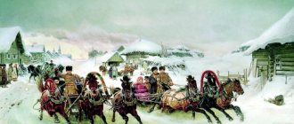
A quiet tale about a cat and a mouse
On a starry night, on a moonlit night, on a thin field path, a little mouse walked cautiously, quietly walked to his home.
And a gray-brown cat quietly trudged towards him, and the mouse saw him, hiding behind a snag.
Eka, he thinks, good luck. I'll refresh myself for a night's sleep. It's painful to wander on an empty stomach.
But the mouse was not a mistake, having recognized the spirit of the cat, he quietly hid behind a hummock, gathering all his will in his tail.
The pitch-black night has come, Not a single star is visible. Quiet in the field, quiet in the sky Grace, as it is - peace.
Here they sit, hiding, And in the pitch silence You can hear an owl flying, Yes, over the field, under the moon.
It's a joke, whoever runs first across the field will give himself away in the night. My heart is beating wildly...
The cat doesn’t want to wait, And the little mouse is trembling all over, Eh, now he should go to his mother - the mouse, She will surround her with care.
But under no circumstances should he run, no, no, no. Otherwise, that's it, I fell for the mouse pate.
Quietly the night passes. The mouse is sleeping, the cat is sleeping. It’s a joke, whoever reveals his dream first will snore...
Cat and cat in the rituals and signs of the ancient Slavs
Combining all of the above into a single picture, we can finally highlight the key abilities of a cat, to which our ancestors attached special importance:
1. ability to purr/tell stories/lull to sleep
- which in folklore is much more important than such a utilitarian function as catching mice. What kind of stories cats tell and why is an open question. Are they healing us? Do they store some encrypted knowledge? (remember the root basis “kosh/kosh”)? Is their fairy tale a sound key for entering the “open field”, “prophetic forest” or noosphere?
2. the ability to “see” something inaccessible to people, otherworldly
- hence the cat’s ability to find the right path, warn and protect its owners from evil spirits.
Maria Molodykh. Painting
That is why:
- “It’s not a hut without a cat” and the cat is the first to be allowed into the new home;
- Kill a cat - no luck in anything for seven years;
- The first meeting of a person in the next world, according to popular belief, will be with a cat - if he treated them poorly during his lifetime, he will not see any good in the other world.
- The cat's behavior predicted the weather and the arrival of guests;
- A cat was valued more than a cow! For its theft, the 14th-century Metropolitan Court Code stipulates a fine of 3 hryvnia, the same as for an ox (for a goose - 30 kn, for a crown - 400 kn);
- You cannot buy a cat; it is customary to exchange it for something symbolic.
______________________
We didn't get out of the trees. We come from the stars. But no matter how far into the depths of thousands of millennia the history of stellar proto-humanity extends, the history of the cat tribe is probably an order of magnitude older. It is for this reason that our ancestors, having once met with this incomprehensible but friendly mind, gave it the respectful name “cat” - “ancient soul”, “guardian soul”. And they invited him to continue the journey together - as a healer, navigator, protector from dark entities, keeper of knowledge and, of course, Friend.